Ctrl+F (Fire) - Climate Change Monitoring Application
Overview
Climate change is the defining challenge of our time. Rising temperatures and changing precipitation patterns contribute to more large-scale wildfires, posing significant health risks and ecosystem damage. 'Ctrl+F (Fire)' is a climate-related application that allows users to visualize atmospheric variables, such as temperature and precipitation, relevant for tracking wildfires at desired locations. The application integrates data from the Copernicus Climate Data Store (CDS), enabling users to explore and interact with climate data.
Outputs
We developed several tools and visualizations as part of this project:
- Jupyter Notebook: Scripts for temperature time series and area-based masking.
- CDS Toolbox Applications:
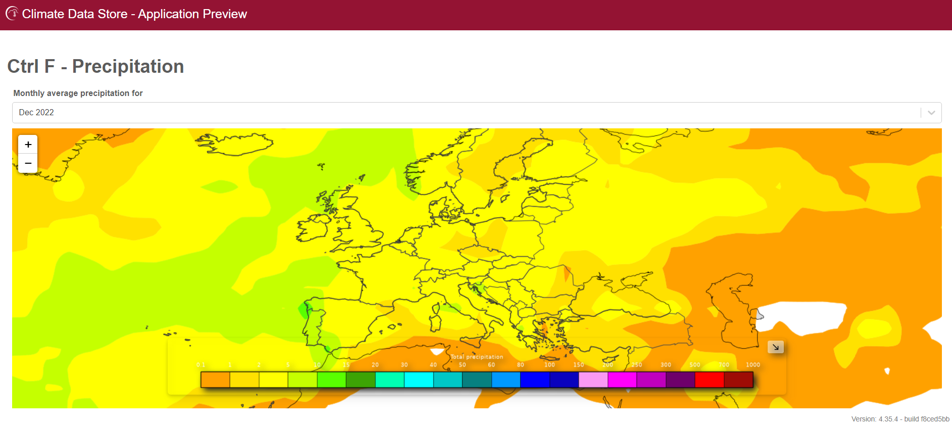
- Precipitation visualization for selected countries or areas of interest.
- Temperature exploration at selected point locations.
The Jupyter Notebook
The notebook leverages libraries like Xarray, GeoPandas, and Matplotlib to analyze and visualize NetCDF files. Notably, it provides geospatial analyses, focusing on Portugal's temperature data, utilizing an Object-Oriented Programming approach for efficient data processing and visualization.
The CDS Toolbox Applications
Applications developed include:
- Precipitation Analysis: Generate maps and time series for precipitation data.
- Temperature Analysis: Visualize annual average temperature and plot monthly trends at specific points.
Challenges and Next Steps
While we achieved key objectives, challenges remain, such as debugging shape-based time series plotting. Our next steps involve unifying datasets, refining application functionalities, and engaging with the CDS Toolbox user community for guidance.
Project Information
- Project: Climate Monitoring Application
- Client: Independent Development
- Project Date: 31 August, 2023
- Project URL: Ctrl+F (Fire)
This project aims to address climate challenges by providing tools to analyze and visualize climate data effectively. It demonstrates the potential of open datasets and geospatial analysis in fostering climate resilience.