SAR Flood Mapping: Change Detection Approach
Project Information
- Project: Flood Mapping Using SAR
- Client: Universite Bretagne Sud
- Project date: November, 2023
- Project URL: Flood Mapping for Pakistan
- Key Skills: SAR Data Analysis, Remote Sensing, Change Detection, Flood Mapping, Google Earth Engine, Code Documentation
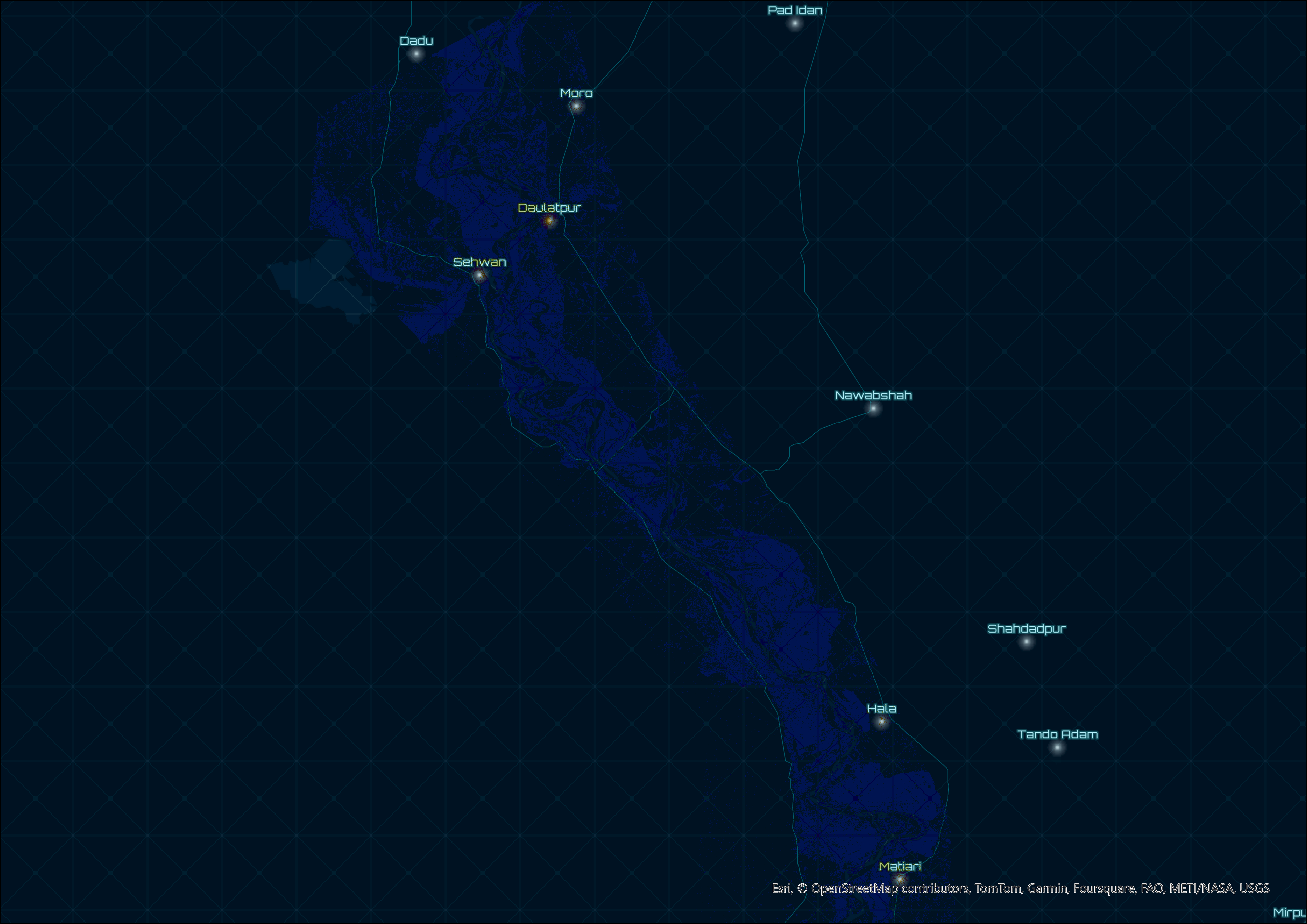
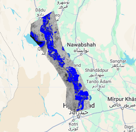
Within this project, Sentinel-1 SAR data is used to generate flood extent maps through a change detection approach. The method compares pre- and post-event images to identify flooded areas. Sentinel-1 GRD imagery with preprocessing steps like Thermal-Noise Removal, Radiometric Calibration, and Terrain Correction is utilized, and additional Speckle Filtering is applied.
Project Overview
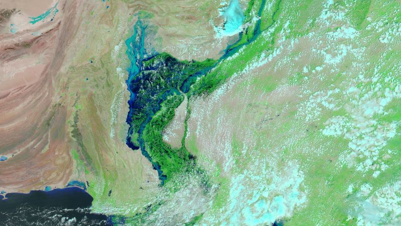
This project leverages Sentinel-1 SAR (Synthetic Aperture Radar) data to map flood-affected areas using a change detection approach. The method relies on analyzing radar images captured before and after a flood event. By identifying changes in surface backscatter, areas inundated by water can be delineated accurately.
Ground Range Detected (GRD) images are used, which have undergone preprocessing steps such as Thermal Noise Removal, Radiometric Calibration, and Terrain Correction. To improve the quality of the radar images and minimize noise, a Speckle Filtering technique is applied.
The resulting flood extent maps are invaluable for disaster management, relief efforts, and studying the impact of floods in affected regions. This approach is computationally efficient and leverages the capabilities of Google Earth Engine for large-scale geospatial analysis.